PicoVoyage

Charting your North East escape

Bhutan image 1 Bhutan image 2 Bhutan image 3 Bhutan image 4

Bhutan

Revered indigenously as 'Druk Yul'—the Land of the Thunder Dragon—the Kingdom of Bhutan is a sovereign Himalayan enclave nestled along the eastern ramparts of the formidable cordillera. Renowned globally for its pione...

Explore Bhutan11 places to visit

The destination

About Bhutan

A considered guide to the landscapes, culture, and places that make Bhutan worth discovering.

Revered indigenously as 'Druk Yul'—the Land of the Thunder Dragon—the Kingdom of Bhutan is a sovereign Himalayan enclave nestled along the eastern ramparts of the formidable cordillera. Renowned globally for its pioneering philosophy of Gross National Happiness over gross domestic product, this sequestered realm has fiercely safeguarded its pristine environmental biomes, constitutional forest cover, and deeply entrenched Tantric Vajrayana Buddhist ethos from the homogenizing currents of unchecked global modernity.

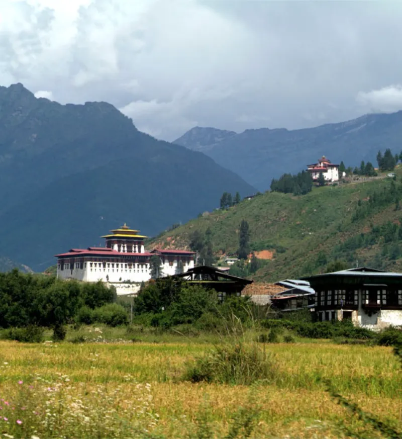
The nation's topography unfolds as a dramatic vertical ascent, sweeping precipitously from the subtropical lowlands bordering the Indian plains to the perennially glaciated, unclimbed citadels of the High Himalayas, dominated by Gangkhar Puensum. Colossal alpine valleys are carved by crystalline river torrents, punctuated at strategic geographical junctures by imposing 'Dzongs'—monumental, whitewashed fortress-monasteries that seamlessly synthesize spiritual administration, defensive architectural genius, and civil governance.

Bhutan caters quintessentially to discerning cultural epicureans, alpinists, and spiritual connoisseurs captivated by archaic monastic festivals (Tshechus), high-altitude trans-Himalayan treks, pristine Himalayan biodiversity, and an unhurried, deeply contemplative cadence of existence. Its carefully calibrated 'High Value, Low Volume' tourism framework preserves an aura of transcendent, exclusive mystical allure found nowhere else on Earth.

Land of the Thunder DragonEastern HimalayasVajrayana BuddhismDzong ArchitectureGross National HappinessTshechu FestivalsPristine EcologyHigh-Altitude TrekkingSpiritual TourismHimalayan Kingdom
Best timeMarch to May
ElevationApproximately 150 meters to 7,570 meters
Typical climateApproximately -5°C to 26°C

Build your itinerary

Places to explore

Start with the experiences that best fit the way you want to travel.

01

Paro Taktsang (Tiger's Nest)

ActivitiesMonastery pilgrimageArduous hikingLandscape photographySpiritual contemplationCultural observation

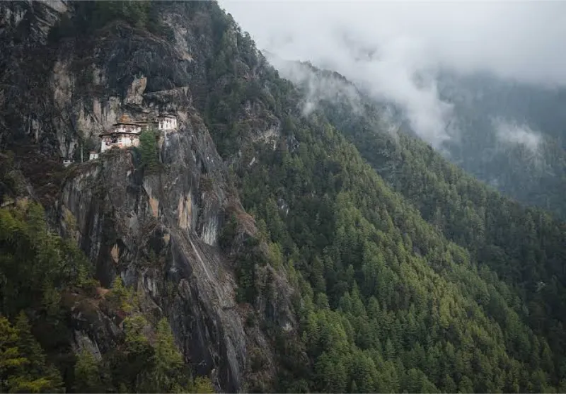
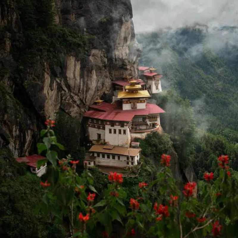
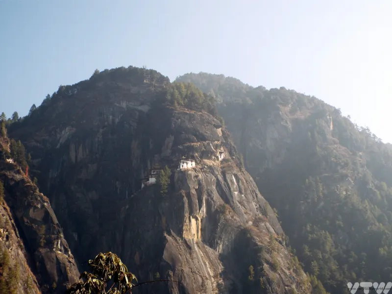
Clinging precariously to a sheer, vertiginous granite cliff 900 meters above the emerald Paro Valley floor, Paro Taktsang is unequivocally the spiritual and architectural zenith of Bhutan. According to venerated hagiography, Guru Padmasambhava (Guru Rinpoche) flew to this sublime cavernous eyrie on the back of a tigress in the 8th century to subjugate localized malevolent spirits and inaugurate Vajrayana Buddhism through sustained meditation.

The pilgrimage to this cliffside sanctum entails a rigorous ascent through whispering blue pine forests adorned with cascades of vibrant prayer flags and the melodic percussion of water-driven prayer wheels. The complex itself is an astonishing architectural feat, featuring interconnected shrines, sacred caves, and precipitous staircases hovering above misty abysses.
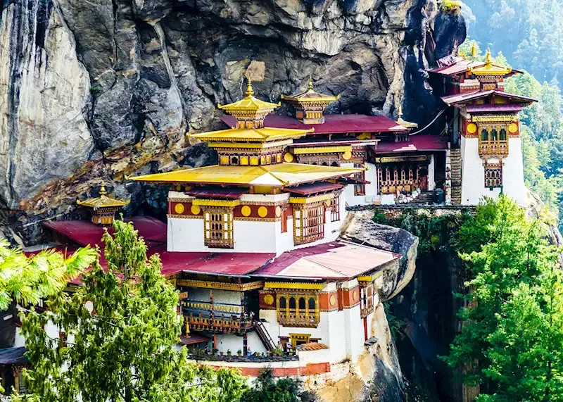
Sacred MonasteryCliffside ArchitectureGuru RinpochePilgrimage SitePhotographyHigh Altitude
Paro Taktsang (Tiger's Nest) image 1 Paro Taktsang (Tiger's Nest) image 2 Paro Taktsang (Tiger's Nest) image 3
02

Thimphu

ActivitiesDzong explorationHandicraft school visitsTraditional archery observationLocal cuisineCity sightseeing

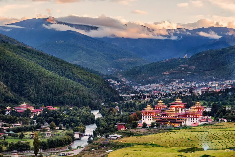
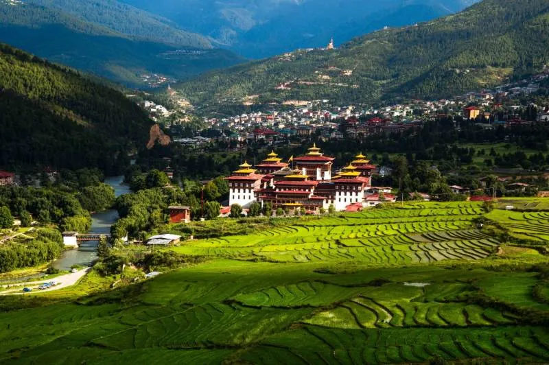
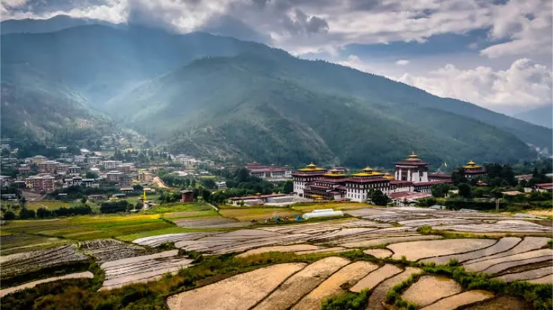
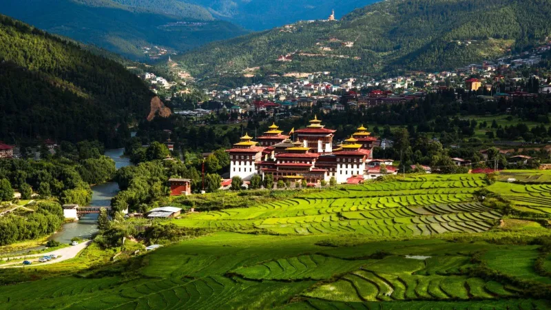
Sprawling across a tranquil, forested valley along the banks of the Wang Chhu, Thimphu represents an intriguing paradox as the kingdom's official capital and its sole metropolis. It holds the unique distinction of being the only world capital devoid of mechanized traffic lights, guided instead by the fluid, ceremonial choreography of traffic constables in ornate wooden kiosks.

The city harmoniously juxtaposes contemporary civic life with archaic traditions, anchored by the colossal Tashichho Dzong—the seat of government and the monastic body—and the monumental Buddha Dordenma, a gilded bronze colossus overlooking the valley. Thimphu functions as the intellectual and artisanal heartland, where centuries-old weaving, painting, and sculpting lineages are rigorously sustained.

Capital CityTashichho DzongBuddha DordenmaArtisanal CraftsCultural HubHimalayan Metropolis
Thimphu image 1 Thimphu image 2 Thimphu image 3
03

Punakha Dzong

ActivitiesDzong architecture toursSuspension bridge walkingRiverbank photographyHistorical appreciationRiver rafting

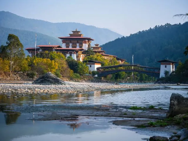
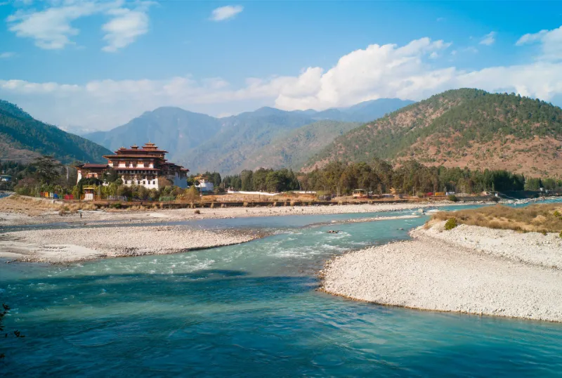
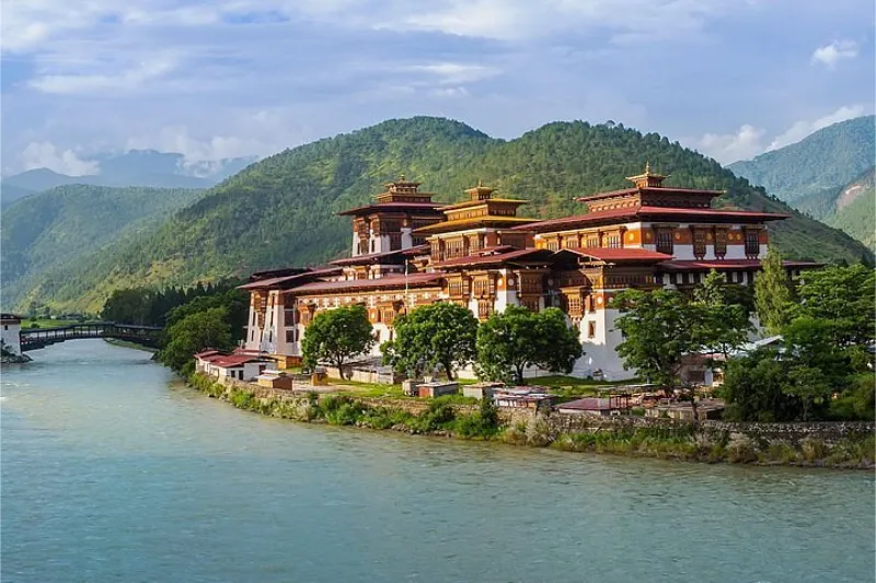
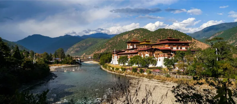
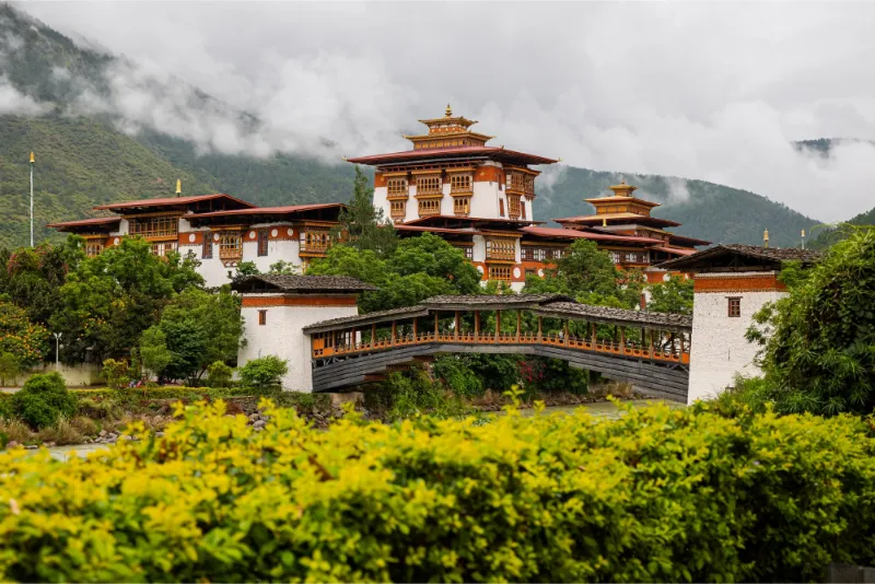
Widely venerated as the 'Palace of Great Happiness,' Punakha Dzong is celebrated as the most aesthetically sublime and historically momentous fortress-monastery in Bhutan. Majestically positioned at the romantic confluence of the celestial Pho Chhu (father) and Mo Chhu (mother) glacial rivers, this sprawling architectural masterpiece served as the ancestral capital of the kingdom until the mid-20th century.

Blessed with an idyllic, balmy subtropical microclimate, the dzong is renowned for the dramatic contrast of its gleaming white walls against blossoming purple jacaranda trees during spring. Inside lie cavernous, intricately carved courtyards, gilded murals of Buddhist cosmography, and the sacrosanct Machen Lhakhang, preserving the embalmed remains of the unifier of Bhutan, Zhabdrung Ngawang Namgyal.

Fortress MonasteryRiver ConfluenceHistorical CapitalJacaranda BlossomsArchitectureSacred Relics
Punakha Dzong image 1 Punakha Dzong image 2 Punakha Dzong image 3
04

Phobjikha Valley (Gangtey)

ActivitiesNature trail walkingBirdwatchingMonastery visitsLandscape photographyEco-village immersion

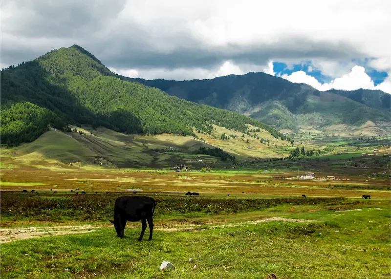
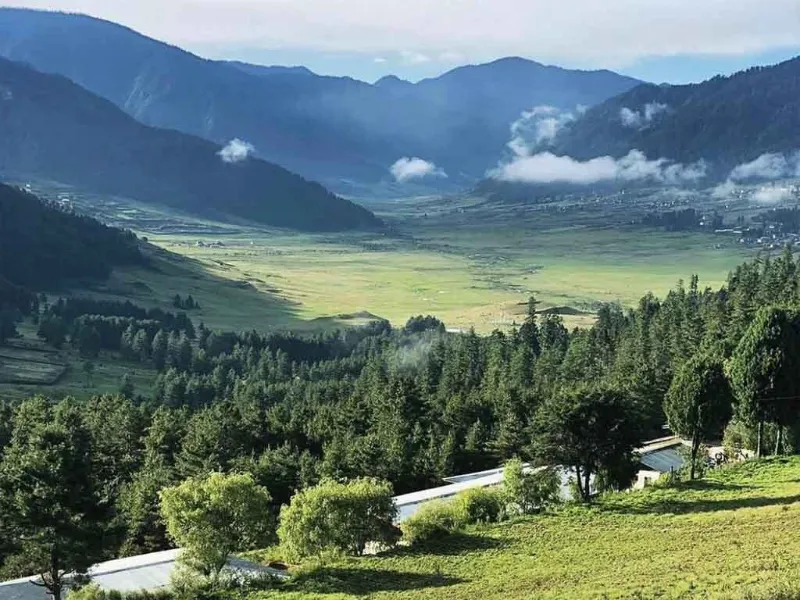
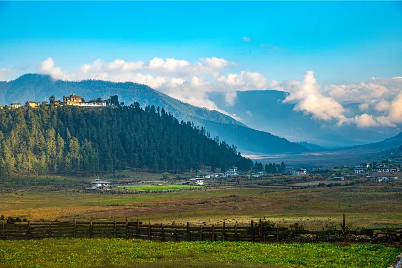
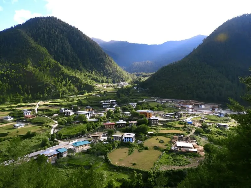
The Phobjikha Valley is a breathtaking, expansive U-shaped glacial vale nestled along the western slopes of the Black Mountains. Devoid of overhead electrical wiring to preserve avian flight paths, this ecologically pristine sanctuary is world-renowned as the winter roosting haven of the endangered, sacred Black-necked Cranes (Grus nigricollis), which migrate annually across the high Tibetan Plateau.

Perched on a forested ridge overlooking the broad valley floor stands the venerable 17th-century Gangtey Monastery, an important seat of the Nyingma Buddhist lineage. The landscape provides an ethereal, pastoral expanse of dwarf bamboo, meandering streams, and crisp alpine air, offering an immaculate haven for ambulatory trail walking.

Glacial ValleyBlack-Necked CranesGangtey MonasteryEcotourismAlpine NatureWildlife Sanctuary
Phobjikha Valley (Gangtey) image 1 Phobjikha Valley (Gangtey) image 2 Phobjikha Valley (Gangtey) image 3
05

Dochula Pass

ActivitiesPanoramic mountain viewingStupa circumambulationPhotographyBotanical garden exploration

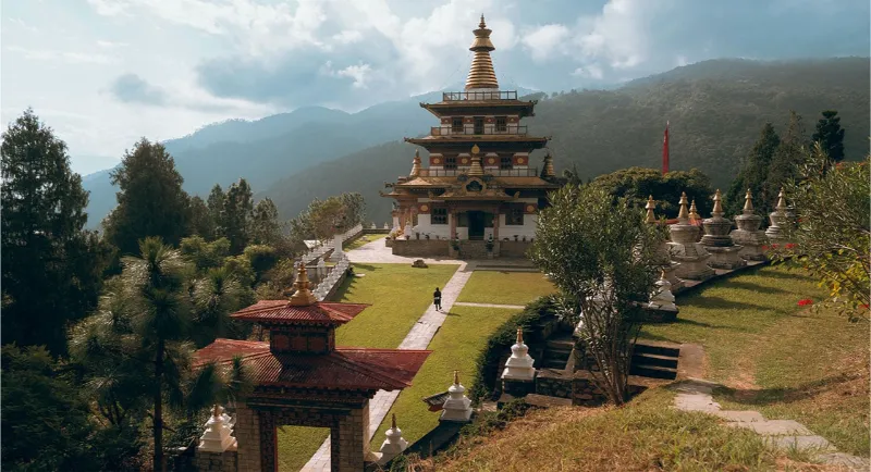
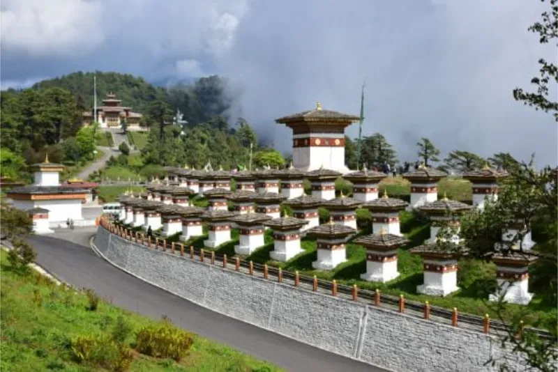
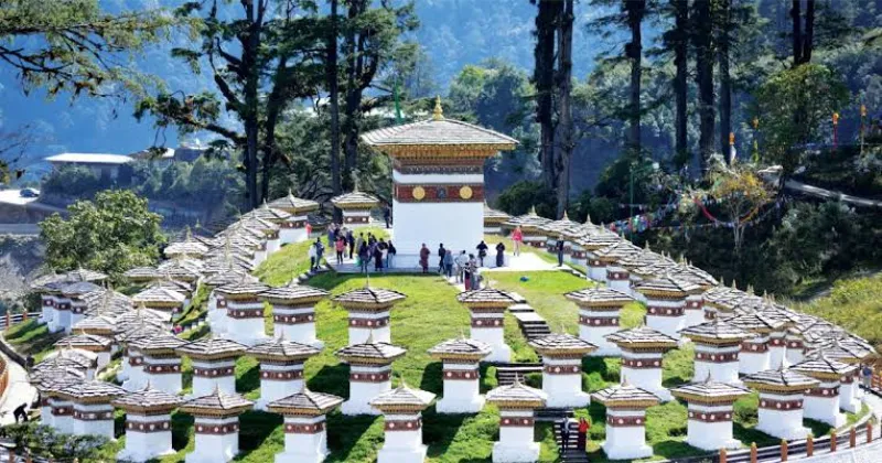
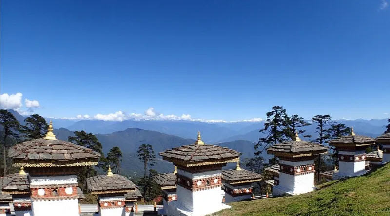
Situated along the arterial mountain thoroughfare connecting Thimphu and Punakha at an elevation of 3,100 meters, Dochula Pass is a dramatic, high-altitude vantage point. The summit is adorned with the mesmerizing Druk Wangyal Chortens—a regal assembly of 108 memorial stupas commissioned to honor the fortitude of Bhutanese soldiers.

On pellucid autumn and winter mornings, the pass commands an unobstructed, monumental 360-degree panorama of the snow-clad Eastern Himalayan cordillera, including the sacred summit of Masanggang and Gangkhar Puensum. Shrouded in ethereal mists or bathed in crisp sunlight, Dochula represents an unforgettable intersection of spiritual artistry and Himalayan geography.

Mountain Pass108 ChortensHimalayan ViewsMemorial StupasPhotographyScenic Panorama
Dochula Pass image 1 Dochula Pass image 2 Dochula Pass image 3
06

Bumthang Valley

ActivitiesTemple pilgrimagesTextile workshop toursValley trekkingLocal food tastingPhotography

Universally revered as the spiritual heartland of the kingdom, the Bumthang region comprises four interconnected, high-altitude valleys: Chokhor, Tang, Ura, and Chumey. This pastoral, undulating landscape is saturated with the legends of great Buddhist saints, housing some of the oldest religious structures in the Himalayas, including the 7th-century Jambay Lhakhang and the hallowed Kurjey Lhakhang.

Bumthang is equally celebrated for its distinctive agrarian heritage, distinguished by rolling buckwheat fields, apple orchards, Swiss cheese processing dairies, and the production of intricate, hand-woven 'Yathra' woolen textiles. Its bucolic, medieval serenity offers a deeply immersive journey into archaic Himalayan spiritual and community life.

Spiritual HeartlandAncient TemplesTextile WeavingPastoral ValleysSacred SitesCultural Heritage
07

Haa Valley

ActivitiesRustic village explorationAlpine day hikesTemple visitsCultural observationLandscape photography

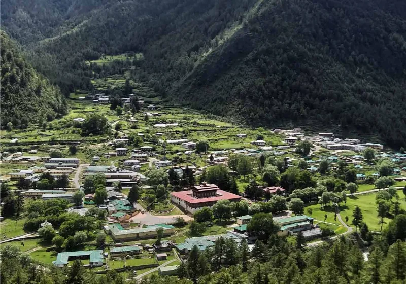
Only recently unveiled to international exploration, the pristine Haa Valley represents one of the most secluded and ancestrally preserved districts in western Bhutan. Dominated by the soaring, sacred trio of hills known as Meri Puensum (The Three Brother Hills), this steep alpine vale is enveloped in ancient animistic traditions and shamanistic folklore that predate the arrival of Buddhism.

The valley floor is graced by the revered Lhakhang Karpo (White Temple) and Lhakhang Nagpo (Black Temple), believed to have been established simultaneously in the 7th century by the Tibetan King Songtsen Gampo. Haa’s unblemished, rustic hamlets, extensive alpine meadows, and absence of mass tourism make it a paradise for contemplative, off-the-beaten-track wayfarers.

Secluded ValleyAncient ShrinesPristine AlpineShamanic HeritageOffbeat TravelNature
Haa Valley image 1 Haa Valley image 2
08

Chele La Pass

ActivitiesHigh-altitude sightseeingJomolhari viewingRidge hikingPhotographyBirdwatching

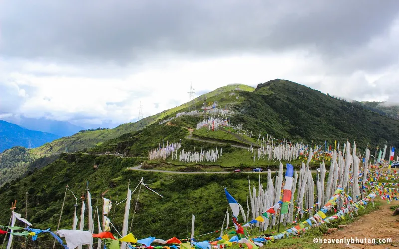
Reaching an elevation of approximately 3,988 meters, Chele La Pass holds the prestigious distinction of being the highest motorable road pass in the Kingdom of Bhutan. Carving an umbilical traverse between the verdant Paro Valley and the remote sanctuary of Haa Valley, the pass is framed by sweeping alpine tundras and dense forests of dwarf rhododendrons.

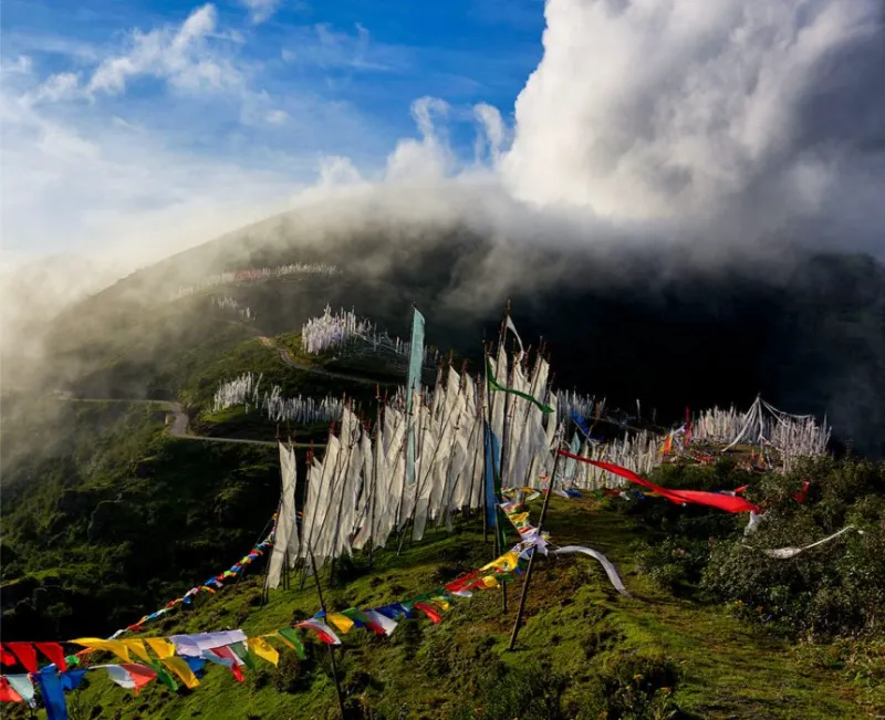
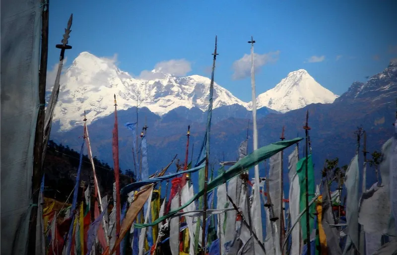
The crest of the pass is an awe-inspiring, windswept spectacle, densely forested with thousands of fluttering white prayer flags (Manidhar) erected in memory of departed souls. On crystalline days, travelers are rewarded with breathtaking, unobstructed vistas of Mount Jomolhari (7,314m)—Bhutan's sacred 'Bride of the Kangchenjunga'—and the surrounding jagged glacial summits.

Highest Motorable PassPrayer FlagsJomolhari ViewsRhododendron ForestsHigh AltitudePhotography
Chele La Pass image 1 Chele La Pass image 2 Chele La Pass image 3
09

Paro International Airport

ActivitiesArrival by airAirport viewingPhotographyScenic approachTravel planning

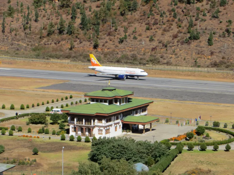
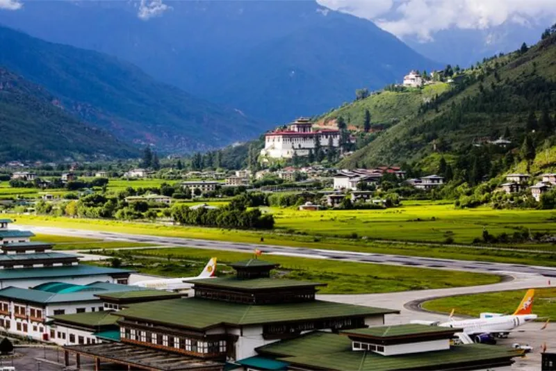
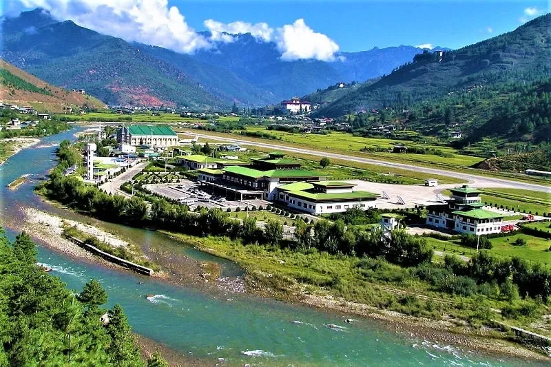
Paro International Airport is the kingdom's sole international gateway and one of the most dramatic aviation approaches in the world. Set amid steep Himalayan ridges, it offers a spectacular first glimpse of Bhutan's mountain scenery before the journey even begins.

The airport acts as a symbolic entry point into the kingdom, where travelers transition from bustling regional transit to the serene pace of Bhutanese life. Its remote mountain setting and modern operating standards make it both a logistical gateway and a memorable arrival experience.

Gateway to BhutanParo ValleyMountain AirportArrival ExperienceScenic ApproachTravel
Paro International Airport image 1 Paro International Airport image 2 Paro International Airport image 3
010

Phuentsholing

ActivitiesBorder entryTown sightseeingCultural observationRoad journeyPhotography

Phuentsholing is Bhutan's principal southern border town and the main gateway for overland travelers entering the kingdom from India. Positioned along the foothills of the Himalayas, the town blends Bhutanese administrative life with busy cross-border commerce and a strategic location near the Jaigaon corridor.

The settlement serves as a transition point between the plains of India and the higher mountain valleys of Bhutan. It offers a practical introduction to the country's customs, architecture, and geography before visitors continue toward Thimphu, Paro, and the interior regions.

Border TownSouthern GatewayCross-Border TradeBhutanese TownTravel HubMountain Access
Phuentsholing image 1 Phuentsholing image 2 Phuentsholing image 3
011

Simply Bhutan

ActivitiesCultural immersionPhotographyTravel inspirationVisual storytellingExperience overview

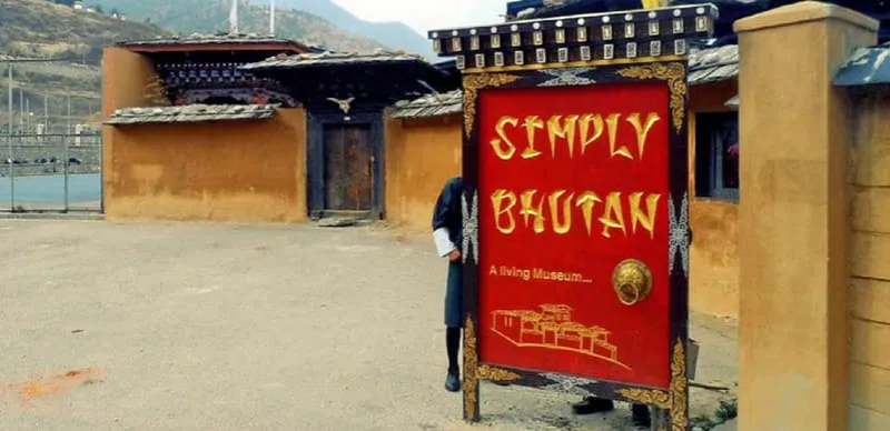
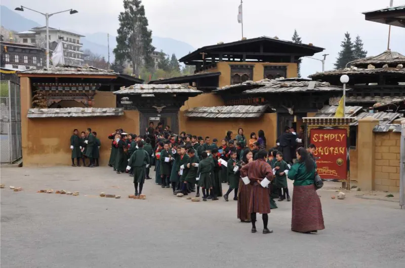
Simply Bhutan captures the essence of the kingdom's cultural identity through a curated, immersive expression of its people, landscapes, and traditions. It serves as a thematic window into Bhutan's values, heritage and visual storytelling beyond a single destination landmark.

This experience reflects the broader Bhutanese journey—melding serene mountain settings, living traditions, hospitality, and a deep respect for spiritual continuity. It is a fitting representation of the kingdom's overall travel experience in a compact, evocative form.

Bhutan ExperienceCultureLandscapesHeritageTravel StoryScenic Journey
Simply Bhutan image 1 Simply Bhutan image 2 Simply Bhutan image 3

Plan with confidence

Travel details

Practical information for planning your time in Bhutan.

When to go

Primary
March to May
Secondary
September to November
Description

The supreme temporal windows for traversing the Kingdom of Bhutan correspond with the vernal awakening in spring (March to May) and the crystalline, dry post-monsoon autumn (September to November). Spring carpets the mid-altitude ridges in an explosion of wild rhododendrons, magnolias, and alpine flora, coinciding with the world-famed Paro Tshechu festival.

Autumn offers peerless atmospheric clarity, crisp cerulean skies, and razor-sharp, unobstructed panoramas of the snow-clad High Himalayas, alongside the arrival of the endangered Black-necked cranes in Phobjikha and the vibrant Thimphu Tshechu celebrations.

The winter solstice (December to February) brings brilliant sunlit days and sharp frosts across central valleys with minimal crowds, while the monsoonal months (June to August) bring torrential rains, heavy cloud cover, and heightened risk of landslides along mountain roads.

Know before you go

Elevation
Value
Approximately 150 meters to 7,570 meters
Unit
meters above sea level
Description

Bhutan features one of the most dramatic vertical topographies on the planet, rising from the subtropical southern foothills along the Indian border to the rarefied, glaciated summit of Gangkhar Puensum (7,570m)—the world's highest unclimbed peak.

Climate
Average Range
Approximately -5°C to 26°C
Summer
Approximately 15°C to 26°C
Winter
Approximately -5°C to 14°C
Description

The climatology varies extensively with elevation. Southern border towns remain tropical to subtropical year-round, whereas the central inhabited valleys (Paro, Thimphu, Bumthang) enjoy temperate summers and cold, dry winters. High-altitude alpine zones remain perpetually arctic.

How to reach

By Air
Name

By Air

Paro International Airport (PBH) is the sole international aviation gateway into the kingdom, renowned for its dramatic visual approach between 5,500-meter peaks.

The national carriers, Drukair and Bhutan Airlines, operate scheduled international flights connecting Paro with major regional hubs including New Delhi, Kolkata, Bagdogra, Guwahati, Kathmandu, Bangkok, and Singapore.

By Rail
Name

By Rail

While Bhutan maintains no domestic railway network, overland rail access is facilitated via adjacent Indian railheads in West Bengal and Assam.

Hasimara Railway Station (approximately 18 km from the border town of Phuentsholing) and New Alipurduar or New Jalpaiguri (NJP) serve as the primary rail disembarkation points for travelers entering Bhutan terrestrially.

By Road
Name

By Road

Overland entry into Bhutan is permitted through designated international border checkposts. The primary and most popular vehicular gateway is the southern border town of Phuentsholing (accessible from Jaigaon, West Bengal).

Alternative terrestrial entry corridors include Gelephu in south-central Bhutan and Samdrup Jongkhar in southeastern Bhutan (accessible from Guwahati, Assam). From the border, well-maintained arterial mountain highways climb toward Thimphu and Paro.

Seasonal guide

Name

Spring

Months
March to May
Temperature
Approximately 12°C to 23°C
Description

Spring brings balmy warmth, vibrant botanical blooms across the mountain passes, and optimal trekking conditions. It is the premier cultural season for witnessing major Buddhist monastic festivals.

Name

Monsoon

Months
June to August
Temperature
Approximately 16°C to 26°C
Description

The southwest monsoon brings heavy, localized rainfall and dense mists to the southern foothills and mountain passes, rendering the valleys vividly green while occasionally impacting flight schedules and road transit.

Name

Autumn

Months
September to November
Temperature
Approximately 10°C to 20°C
Description

Autumn is universally celebrated as the golden season of Bhutan, distinguished by dry weather, sublime mountain visibility, golden rice harvest terraces, and significant religious celebrations.

Name

Winter

Months
December to February
Temperature
Approximately -3°C to 14°C
Description

Winter ushers in crisp, sun-drenched days with biting sub-zero temperatures at night. Snowfall intermittently blankets higher passes such as Dochula and Chele La, creating dramatic, pristine alpine vistas.